
The longer the flight for a data retrieval mission, the more time this technology saves field teams. However, long autonomous flights using off-the-shelf UAS technology require very careful planning in order to minimize the risk of injury or loss of the UAS.
Mission Planning
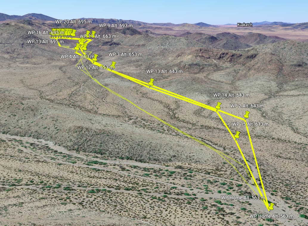
Generally, the closer the UAS is to the data station, the faster the download speed. However, in order to avoid terrain and account for sudden wind gusts or changes in direction, it’s important to plan flights such that there is a wide buffer between the aircraft and all terrain at all times–vertically and horizontally.
Regardless of your mission planning software, we recommend exporting the flight plan as a KML file and inspecting the flight plan using terrain-enabled 3D mapping software to verify the UAS will remain clear of local terrain at all points during the flight (not just at the waypoints). Google Earth is free and supports KML importing natively.
Regulations
Laws surrounding personal and professional use of UAS vary from place to place and are often changing. It is crucial that your team stays up to date with current UAS regulations in the area you plan to fly in order to avoid serious legal consequences. Without special written permission from your local air traffic control agency, these regulations will likely limit the altitude and distance of your data mule flights.